
Why Does the Same House Drain Differently in Baton Rouge and Denham Springs?
The rain and the soil are closer than most people think. NOAA’s normals put Baton Rouge’s airport at 61.94 inches of rain a year and Denham Springs at 64.32, and the same slow, silty soils show up on both sides of the Amite. What changes is height and the outlet: how far the water can fall, and if the ditch it drains to is already full.
TLDR:
- NOAA normals show 61.94 inches of rain a year at the Baton Rouge airport and 64.32 at Denham Springs, about 4 percent apart
- Slow-draining silty terrace soils show up on both sides of the river, and several have USDA type locations in East Baton Rouge Parish
- Olivier, a loess soil described near Plains, has a dense fragipan that keeps the soil above it saturated from December to April
- NOAA lists its Baton Rouge airport station at about 64 feet of elevation and its Denham Springs station at about 35 feet
- One river gauge at Denham Springs tracks flooding on both sides, from Jones Creek in Baton Rouge to west Denham Springs
- Buried drain lines need an outlet that stays lower and drier than the yard; flat, low lots usually do better with surface routes
We install gutters and downspouts on both sides of the Amite, from Baton Rouge to Denham Springs. A question we hear often comes from people who moved across the river: the downspout setup that kept their old yard dry is now leaving water at the slab.
The house did not change. The ground under it, how high it sits and where the water can go next all did. Here is what the public data says about each one, and what it means for the plan.
Not sure where your roof water should go? We will walk the lot, find the low spots and the outlet, and plan the gutters and downspouts around them.
Is the Rain Really Different Across the River?
Barely. The two NOAA stations sit about 12 miles apart, and their official 1991 to 2020 normals show rain totals within a few inches of each other.
The Baton Rouge airport normals and the Denham Springs station normals line up like this:
| NOAA station (1991 to 2020) | Rain per year | Days with 1 inch or more | Days with 2 inches or more | Station elevation |
|---|---|---|---|---|
| Baton Rouge airport | 61.94 in | 19.2 | 6.2 | 19.5 m (about 64 ft) |
| Denham Springs | 64.32 in | 20.6 | 6.6 | 10.7 m (about 35 ft) |
Denham Springs gets slightly more rain and about one more heavy day a year. That is real, but it is not enough on its own to change a downspout plan. The last column matters more, and we will come back to it.
For the parish-wide picture east of the river, our guide to Livingston Parish soil and rainfall covers three NOAA stations and the local soil series in detail.
Is the Soil Worse in Denham Springs?
Not as a rule. The slow, silty soils people blame on Livingston Parish run right across the river into East Baton Rouge Parish, and the USDA’s own records show it.
The Verdun series was established in Livingston Parish in 1931, but its type location is in East Baton Rouge Parish, about 2.6 miles west of the Amite. The USDA describes a seasonal high water table “perched at depths of 0.5 to 1.0 feet, December through April.”
Three more series have type locations in East Baton Rouge Parish:
| Soil series | USDA type location | Drainage | Wet-season water |
|---|---|---|---|
| Olivier | 1 mile west of Plains | Somewhat poorly drained | Saturated above the fragipan from about 1 to 2.5 ft down, Dec to Apr |
| Deerford | Edge of Zachary | Somewhat poorly drained | Perched at 0.5 to 1.5 ft, Dec to Apr |
| Calhoun | 0.6 mile east of Deerford | Poorly drained, very slow internal drainage | Slow to very slow runoff |
| Verdun | 2.6 miles west of the Amite | Somewhat poorly drained | Perched at 0.5 to 1.0 ft, Dec to Apr |
The Olivier series is worth a closer look. It formed in loess, and its type location sits near Plains, in the north of the parish. Its subsoil holds a fragipan, a dense layer that water moves through slowly. The USDA says the soil “is saturated in the layers that are below a depth of about 1 to 2.5 feet and above the fragipan from December to April in normal years.”
The Deerford and Calhoun descriptions tell the same story in different words. On both sides of the river, winter water sits close to the surface because it has nowhere to soak in. That one fact rules out a common fix, which we cover below.
What Actually Changes: Height and the Outlet
Every drop of roof water needs two things: enough fall to keep moving, and somewhere to go at the end. That is where two lots across the river can differ most.
Start with height. NOAA’s station records list the Baton Rouge airport at 19.5 meters and the Denham Springs station at 10.7 meters, as the table above shows. Two weather stations are not a map of either city, and plenty of Baton Rouge streets sit low. But a lower, flatter yard has less fall to work with, and a lot near a creek or the river sits closer to the water its drains empty into.
Then the outlet. The National Weather Service tracks the Amite River at Denham Springs and lists what floods at each river level. Flooding begins in the westernmost parts of Denham Springs at 29 feet. At 35 feet, the service lists moderate flooding around Clay Cut Bayou, Jones Creek and Honey Cut Bayou on the Baton Rouge side, and Denham Springs west of Florida Avenue.
The point is not that one city floods and the other does not. Local creeks on both sides empty toward the same river. The weather service even files its gauges on Ward Creek at Government Street, Jones Creek and Dawson Creek in Baton Rouge under the Amite River Basin. When the river is up, those channels back up, and a drain line that empties into them has nowhere to send water.
Is your yard draining to a ditch that fills up first? We will find where your water goes and route the downspouts to an outlet that keeps working in a storm.
Matching the Drainage Plan to the Lot
The city name is shorthand. What decides the plan is how much fall your lot has and what the water drains into. Most homes fit one of these four cases.
| Your lot | What usually works | What to avoid |
|---|---|---|
| Higher ground, clear fall to a street or ditch that stays well below the yard | A buried downspout line that daylights at a lower outlet | Ending the line in a flat spot where it can silt up |
| Flat lot with little natural fall | Above-ground extensions, shallow swales and regrading near the house | Long buried lines that cannot keep a steady downhill slope |
| Low lot near a creek, bayou or ditch that runs full in storms | Surface routes that spread water over the yard, away from the slab | Outlets set below the ditch’s normal storm level |
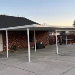
| Patio slab or patio cover in the water’s path | A gutter on the cover and a route around the slab | Downspouts that empty onto the slab edge |
The first case is more common on higher Baton Rouge lots, and the second and third show up more often toward the river. But we have seen all four on both sides, sometimes on the same street.
For the code side of grading, our guide to standing water at the foundation covers the required slope away from the house and where downspouts should discharge.
Why a Dry Well Often Fails Here
A dry well, or a gravel pit at the end of a downspout, works by letting water soak into the ground below. It only works where the ground can take the water.
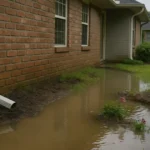
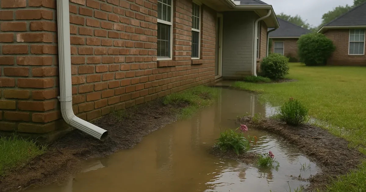
The soil records above show the problem. In winter, when rain is steady, several of these soils are already saturated or holding perched water within 0.5 to 2.5 feet of the surface. A pit dug into that layer starts the storm already full.
That does not mean every underground fix fails. It means the outlet has to be somewhere lower, not straight down. On a flat or low lot, that often means taking the water across the surface instead.
What This Changes for Gutters and Downspouts
The gutter itself does not care which side of the river it is on. Where the downspouts land does.
- Place downspouts where the water has a path. The right corner is the one with fall away from the house, not the one closest to the drive.
- Size for the heavy days. NOAA stations in both cities average six or more 2-inch rain days a year. Our guide to downspout sizing shows when a bigger outlet beats an extra one.
- Treat the patio cover as its own roof. A cover sheds a lot of water onto the exact spot people use. Our post on patio cover gutters covers when one needs its own gutter.
On new installs, we plan the downspout locations before the gutter is formed. That lets a seamless gutter install in Denham Springs or a downspout install in Baton Rouge start with the outlet, not end with it.
How to Read Your Own Lot Before the Next Storm
You can learn most of what matters in a weekend with free tools and one good rain. Here is the order we would follow.
- Look up the soil. The USDA’s Web Soil Survey maps the soil series for any address.
- Check the flood map. FEMA’s Flood Map Service Center shows the mapped flood zone for your address.
- Find the outlet. Walk the path water takes off your lot. Note the curb inlet, roadside ditch, creek or bayou at the end of it.
- Watch a heavy rain. Note where water sits at the house, where each downspout empties, and how high the ditch gets.
- Look again the next day. Water still standing a day later points to a low spot or an outlet that backed up.
Bring those notes to any drainage conversation. They will tell a contractor more than a guess based on the town name.
What Baton Rouge and Denham Springs Homeowners Ask About Yard Drainage
These are the questions we hear most from homeowners on both sides of the Amite. The short answers below point back to the data above.
Does Denham Springs get more rain than Baton Rouge?
Slightly. NOAA’s 1991 to 2020 normals show 64.32 inches a year at the Denham Springs station and 61.94 inches at the Baton Rouge airport. Denham Springs also averages about one more day a year with an inch of rain or more. The gap is small, so rain alone rarely explains why one yard drains worse than another.
Is the soil worse in Denham Springs than in Baton Rouge?
Not as a rule. USDA records show slow, silty terrace soils on both sides of the river, and several have type locations in East Baton Rouge Parish. Olivier, Deerford and Verdun all hold water close to the surface from December to April. Look up your own address in the Web Soil Survey before assuming.
Should I bury my downspouts?
Only if the line can keep falling to an outlet that stays lower than the yard, even in a storm. On a higher lot with a clear path to the street or a ditch, a buried line works well. On a flat or low lot, a buried line can sit full of water, so surface extensions and swales usually work better.
Will a dry well fix standing water in my yard?
Often not here. A dry well only works in ground that can absorb water, and many local soils are already saturated or holding perched water within a few feet of the surface in winter. The pit fills before the storm ends. Moving water across the surface to a lower outlet tends to hold up better.
How do I know if my yard drains toward the Amite River?
Follow the water. Find the ditch, creek or curb inlet your lot drains to, then follow it on a map. Many local creeks on the Baton Rouge side, including Jones Creek and Clay Cut Bayou, appear in the National Weather Service’s flood impacts for the Amite at Denham Springs.
Can more downspouts fix a yard that floods?
Sometimes, but only if each new downspout has somewhere to send water. Adding outlets on a flat lot can just spread the puddles around. The better first step is finding the fall and the outlet, then placing downspouts where the water can move away from the house.
Plan the Water Path First
Two identical houses across the Amite can need two different drainage plans. The rain and the soil are close, so the answer is in the lot: how much fall it has, and if the outlet stays clear when the river is up.
As a firefighter-owned company with over 12 years of experience, we start every gutter and downspout job by finding where the water can go. Then we build the system around that path.
Ready for a drainage plan that fits your lot? We will walk the yard, check the outlet and plan the gutters and downspouts to match, on either side of the river.